Our team is ready to help you eliminate wasted time, maximize your sales coverage, and supercharge your team's efficiency. We'll provide the expert guidance and tailored solutions you need to get things right. Stop missing out on valuable opportunities. Reach out, and we'll get started on optimizing your territories today!
READY FOR MAPLINE TO
ROCK
YOUR WORLD?
WE WANT YOU TO EXPERIENCE EVERYTHING! HOW WOULD YOU LIKE TO GET IN TOUCH SO WE CAN GET THINGS STARTED?
READY FOR MAPLINE TO
ROCK
YOUR WORLD?
Discover the potential of Mapline with a LIVE DEMO from our experts. This is your chance to see it in real-time and get all your questions answered. Connect with us to schedule your demo today!
Auto-Generate Territories From Pins automatically creates territory boundaries based on the locations in your map. Instead of manually drawing service areas around customers, sales representatives, facilities, or assets, Mapline analyzes your pin locations and generates territories that organize your data into meaningful geographic regions, saving time while improving consistency.
How to Auto-Generate Territories From Pins
Generate territory boundaries directly from your existing map pins with just a few clicks. This eliminates the need to manually trace service areas while creating a clear geographic structure based on your business data.
Optimize Large Geographic Datasets
As your customer base grows, finding the best way to divide thousands of locations becomes increasingly complex. Auto-Generate Territories From Pins analyzes your geographic distribution to create balanced, efficient territory assignments that support better coverage, resource allocation, and operational planning.
Pro Tip: Filter your map before generating territories to create separate territory maps for specific regions, product lines, customer segments, or business units.
Balance Coverage More Effectively
Manual territory design often leads to uneven workloads, overlapping service areas, or inefficient travel patterns. Automatically generated territories help create more balanced geographic assignments, improving operational efficiency while reducing unnecessary travel and coverage gaps.
Reduce Manual Mapping Effort
Drawing territory boundaries by hand can take hours and often produces inconsistent results. Automatically generating territories accelerates the process while ensuring every location is assigned to a clearly defined geographic area.
Adapt as Your Business Evolves
Customer locations, markets, and service areas change over time, and your territories should evolve with them. Regenerate territories using your latest data to maintain efficient assignments as your business expands, relocates, or enters new markets.
ORGANIZE YOUR GEOGRAPHIC DATA MORE EFFICIENTLY
Plot Locations
EASILY FROM A SPREADSHEET
VISUALIZE
YOUR DATA IN SECONDS
HEAT MAP
YOUR DATA AND UNCOVER KEY PATTERNS
CUSTOM TERRITORY
CREATION AND MANAGEMENT
INCREDIBLE STYLING
AND PIN GROUPING OPTIONS
WHICH TYPES OF AUOT-GENERATED TERRITORIES ARE THERE?
Customer-Based Territories
Generate territories around customer locations to better understand market coverage and organize sales, support, or marketing efforts. Customer-driven territories help teams manage relationships more effectively while identifying opportunities for expansion.
Sales Representative Territories
Automatically group customer locations into territories assigned to individual sales representatives or account managers. Clear geographic assignments improve accountability and reduce territory overlap.
Service Coverage Areas
Generate service territories based on where technicians, crews, or field resources operate. Well-defined service areas improve response times while helping organizations balance workloads across teams.
Facility Service Regions
Create territories surrounding warehouses, offices, retail stores, clinics, or distribution centers. This helps businesses visualize which locations each facility serves while identifying opportunities to improve coverage.
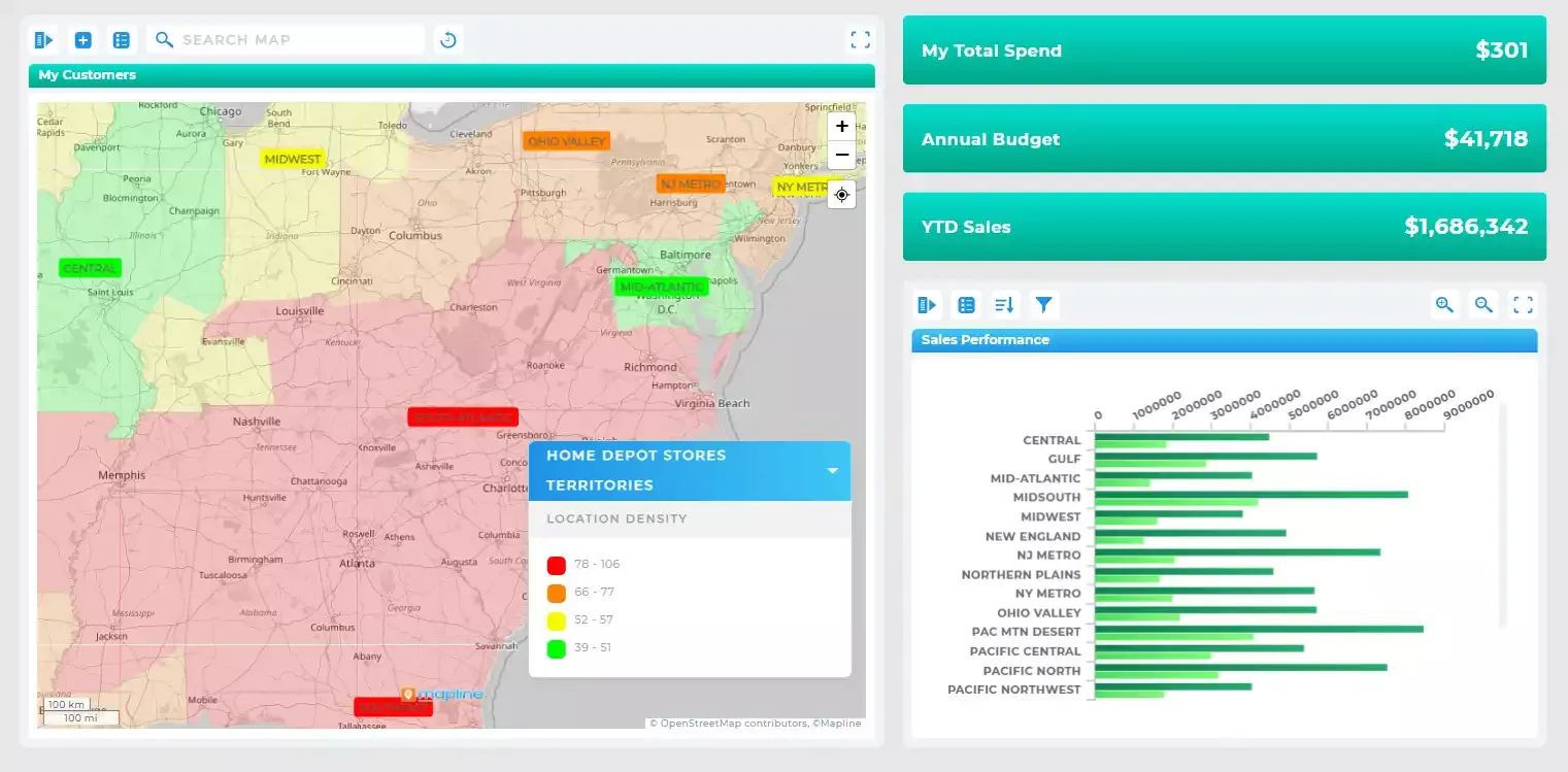
Pro Tip: Combine automatically generated territories with territory statistics to quickly compare customer counts, revenue, or workload across each region.
TURNLOCATION DATAINTOBUSINESS INTELLIGENCE
Make Territory Management More Strategic
Improve Geographic Coverage
Automatically generated territories reveal where coverage is balanced and where opportunities exist to better distribute customers, employees, or resources. Better visibility leads to stronger operational planning.
Scale Territory Planning Faster
As your organization grows, manually maintaining territories becomes increasingly difficult. Automated territory generation allows businesses to expand into new markets without rebuilding territory maps from scratch.
Support Smarter Resource Allocation
Clearly defined territories make it easier to assign personnel, vehicles, inventory, and budgets where they’re needed most. Geographic organization helps ensure resources are distributed efficiently across your operation.
Simplify Ongoing Territory Management
Because territories are built from your location data, updating your maps becomes far easier than redrawing boundaries manually. This keeps territory planning aligned with your latest business information.
Build a Better Foundation for Analysis
Automatically generated territories work seamlessly with Mapline’s dashboards, reporting, routing, heat maps, and geographic analytics. Organizing data geographically creates a stronger foundation for understanding business performance.
Pro Tip: Auto-generated territories are an excellent starting point, but don’t stop there. Customize colors, adjust boundaries, apply filters, and analyze territory performance to create territories tailored to your unique business goals.
CREATE A MAP THAT MOVES WITH YOU
WHATMAKES MAPLINE SODIFFERENT
SIMPLEST MAPPING SOLUTION
Plot multiple locations from Excel in seconds.
No coding, no setup—just copy, paste, and go.
Mapline makes it effortless to build custom maps with pins that transform your spreadsheets into visual insights you can act on immediately. Plot multiple locations from Excel in seconds.
No coding, no setup—just copy, paste, and go.
Mapline makes it effortless to build custom maps with pins that transform your spreadsheets into visual insights you can act on immediately.
POWERFUL MAP-BASED ANALYTICS
Mapline isn’t just a map tool— it’s a full-suite analytics platform.
Create a map, layer on territories, analyze performance, and automate workflows that help your business move faster.
Every map you create becomes a data-powered decision engine. Mapline isn’t just a map tool— it’s a full-suite analytics platform.
Create a map, layer on territories, analyze performance, and automate workflows that help your business move faster.
Every map you create becomes a data-powered decision engine.
Don’t just take our word for it:
“If you’re an advertiser, you want to know the markets I’m in. So, what am I going to do? Print out a spreadsheet? No, of course not. I’m going to use Mapline.”
– Sam Anthony, Your News
“I’m able to get a very complex, very deep and profound analysis.”
– Juan Hernández, RE/MAX
“Thank you Mapline for such an AMAZING program that is saving us money and building confidence in our future growth!”
– Lydia Rogers, Greenworks Commercial
“When people see it, they believe it. I show potential affiliates the map to start, just to show them how many markets we’re in and how we’re expanding.”
Auto-generating territories from pins is an automated method for creating territory boundaries based on the locations of your existing map pins. Instead of manually drawing territories, Mapline organizes your geographic data into logical regions with just a few clicks.
Automatically generated territories are ideal when you need territory assignments optimized for your business—not simply drawn by hand. By creating territories from the actual distribution of your locations, Mapline helps improve coverage, reduce travel, balance workloads, and build territories that support more efficient day-to-day operations.
Yes. Automatically generated territories provide a starting point that you can customize to better match your business needs. You can adjust boundaries, modify territory styles, and continue refining your map as your organization evolves.
You can generate territories from virtually any mapped locations, including customers, prospects, employees, technicians, retail stores, warehouses, offices, service calls, assets, and other business locations.
Administrative boundaries rarely reflect how businesses actually operate. Auto-generated territories are built from your real business locations, helping create more meaningful service areas that better represent customers, operations, and geographic demand.
Yes. You can filter your map before generating territories, allowing you to create territory maps for specific teams, customer segments, regions, products, or other subsets of your data.
Organized territories make it easier to balance workloads, assign resources, identify coverage gaps, improve customer service, and analyze geographic performance. They also simplify collaboration by giving every team a consistent view of service areas.
Absolutely. Auto-generated territories work alongside routing, heat maps, dashboards, reports, geographic analytics, demographic data, and other Mapline capabilities to provide deeper business insights.
Territories are generated from your current map data, so you can regenerate them whenever your locations change. This allows your territory strategy to evolve alongside your business.
Sales teams, field service organizations, logistics providers, retailers, healthcare organizations, utilities, government agencies, and many other businesses use automatically generated territories to organize geographic data and improve operational efficiency.
GEO
Mapping
GET STARTED FOR FREE
No credit card required
One map, two datsets — Completely FREE!
Access to live support and training resources
START MAPPING FOR FREE
Mapping Made Powerful Copyright Mapline Inc. Sales: +1 800.969.1454