AMERICAN SAMOA COUNTIES
- Territory Guide
- AMERICAN SAMOA COUNTIES
Visualizing American Samoa counties can significantly enhance your analytics and optimize operations. By mapping out these counties, you gain insight into local market dynamics, customer behavior, and trends impacting sales. Explore regional trends, spot untapped opportunities, and craft winning business plans that truly resonate.
This is particularly useful for sales teams, marketing strategists, and logistics managers looking to refine their approaches. Let’s unlock the full potential of your insights and fuel smarter, more strategic business decisions! Here’s how!
WHAT ARE AMERICAN SAMOA COUNTIES?
American Samoa is divided into three divisions and 15 counties. Each county is an administrative division with a local government.
In business, adding American Samoa county boundaries to a map provides valuable insights for growth. Brands can leverage county maps to improve their sales strategies, target marketing campaigns more effectively, and streamline logistics operations. Mapping these territories can provide valuable insights into market penetration and operational efficiency. For instance, wholesalers and distributors can analyze resource allocation, optimize delivery services, and make informed decisions to improve their operations.
ADD COUNTIES TO MAP
Imagine you’re a distributor wanting to optimize your delivery routes. With the counties of American Samoa plotted on your map, you gain clarity on each territory, allowing you to enhance the efficiency and cost-effectiveness of your operations. How amazing is that?
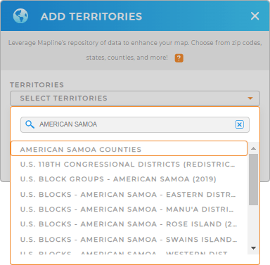
First, add a new territory from Mapline’s repository, simply type AMERICAN SAMOA in the search bar and select AMERICAN SAMOA COUNTIES.
That’s all there is to it! Let’s wrap up the last step and your map will be ready to go.


Pro Tip: Leverage Mapline’s worldwide repository of territories to access additional boundaries for American Samoa, including U.S. blocks, U.S. block groups, U.S. congressional districts, and more.
CHOOSE COUNTY COLORS
Colors are crucial for visually differentiating between areas on your map. Quickly identify key data points and trends at a glance, making it easier than ever to interpret and act on your data.
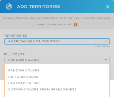
Just select your preferred color styling – random colors, uniform color, heat map, or custom colors from spreadsheet. When you’re done, click OK.
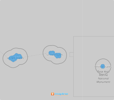
Now your map of American Samoa counties is ready to analyze!

GET NEW TERRITORY INSIGHTS
Unlock more ways to reveal valuable insights hidden in your data with Mapline. Leverage powerful capabilities to enhance your American Samoa counties map:
- Visualize service coverage with coverage areas
- Segment your audience for deeper analytics
- Sort or filter data to improve data management and analysis


