BELARUS DISTRICTS
- Territory Guide
- BELARUS DISTRICTS
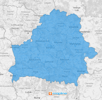
A map of Belarus districts empowers you to tackle challenges in your business head-on. This map isn’t just any old geographical layout; it’s your tool to decipher the intricacies of customer behavior, market dynamics, and sales performance across every corner of the region. Imagine having the power to unlock a whole new realm of strategic insight! Take advantage of a district-level analysis today. Start enhancing your visibility into your operations and navigate through the complex market landscape.
Ready to skyrocket your strategies to reach the peak of your business success? Then let’s create a district map now!
WHAT ARE BELARUS DISTRICTS?
Belarus is split into 118 districts, each one a unique piece of the puzzle in the grand scheme of your business operations. Creating a visual representation of the districts sparks ideas and provides a clear overview of the potential to streamline operations and improve logistics. For example, you’re running a logistics company and want to refine your day-to-day routes. A district territory map can help you craft the most efficient routes for your sales team, minimizing travel time and costs, and maximizing the number of visits.
Include a Belarus districts map to your analysis to drive more ideas for informed decision-making!
ADD BELARUS DISTRICTS
Let’s say you want to monitor the sales performance of your teams across all regions. You can leverage a district territory map to streamline your sales routes. The clarity it presents enables you to plan the most efficient routes for your teams, minimizing travel time and costs, and maximizing the number of visits! That’s just mind-blowing!
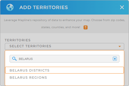
You can achieve that simply by adding a new territory from Mapline’s repository. Just type BELARUS in the search bar and select BELARUS DISTRICTS.
One last step and you’re good to go.


Pro Tip: Mapline’s Repository, provides a comprehensive list of worldwide territory boundaries. Explore these regions including Belarus regions and districts to gain deeper insights into your data.
CHOOSE DISTRICT COLORS
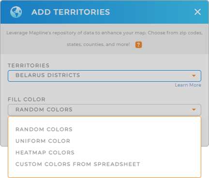
Now, improve the quality of your analysis as you apply colors to your district territory. You can use custom colors for brand consistency. Apply heat map colors to show your sales volumes in different areas. If you want a straightforward visualization, use a uniform color throughout your map. You can also apply random colors for distinct separation of each district.
Whatever you choose, you’re in for a treat as you apply color styling to your map. Click OK, and we’re done!
Go ahead and start analyzing your data on a map of Belarus districts.

GET NEW TERRITORY INSIGHTS
Now, these powerful capabilities help you to unlock a wealth of new insights when analyzing your Belarus district map:
- Mitigate risks by segmenting your data and implement proactive measures
- Leverage sales performance reports across different districts
- Create interactive dashboards to track market penetration by district


