COSTA RICA PROVINCES
- Territory Guide
- COSTA RICA PROVINCES
Add Costa Rica Provinces to your maps and enhance your strategic decision-making with detailed regional insights. This detailed provincial map allows you to identify high-performing areas, uncover growth opportunities, and understand where to focus your efforts. Pinpoint where your products are most popular, which regions need more support, or which areas need more advertising.
Let’s review how to quickly add Costa Rica provinces to your maps and turn your analysis into actionable insights that drive success. Check it out!
WHAT ARE COSTA RICA PROVINCES?
Costa Rica is divided into seven provinces, each governed by local administrative units. These provinces are essential for understanding regional differences in demographics, consumer behavior, and market trends.
You can leverage provincial maps to analyze market penetration, manage distribution networks, or develop region-specific marketing strategies. Mapping provinces provides a clearer understanding of regional dynamics, leading to more informed and effective business decisions.
ADD COSTA RICA PROVINCES
When you incorporate Costa Rica province boundaries into your maps, you’ll be able to see how your KPIs compare to regional boundaries. You can even map consumer behavior and view how your competitors compare in each province.
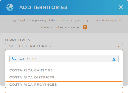
First, add a new territory from Mapline’s repository, then type COSTA RICA in the searchbar. Select COSTA RICA PROVINCES, and you’re ready for the next step.
Woah, that was fast!


Pro Tip: Mapline’s worldwide territory repository offers an extensive list of territory boundaries, enabling you to explore new regions and gain deeper insights into your data. By adding various territories such as Costa Rica cantons or Costa Rica districts, you can uncover new opportunities and refine your strategies.
CHOOSE PROVINCE COLORS
Color-coded provinces help you quickly identify performance metrics, demographic trends, and regional patterns at a glance, optimizing your decision-making process.
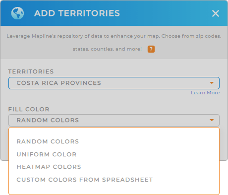
Simply select your preferred type of color styling from the drop-down menu, click OK, and you’re good to go!
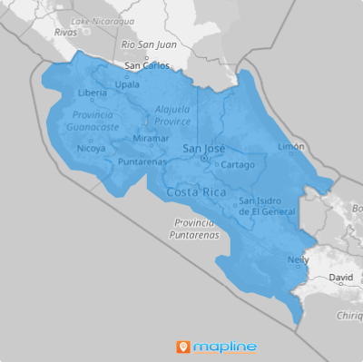
Now, your map is a visual aid that highlights critical data points so you can dig into your data on demand. How cool is that?

GET NEW TERRITORY INSIGHTS
Now, you have the power to unlock a wealth of insights with your map of Costa Rica provinces:
- Hone in on specific regions within provinces with custom shapes to draw attention to targeted areas for special initiatives or analysis
- Automatically label provinces with critical data points such as sales figures, population statistics, or other custom metrics for quick reference
- Adjust territory styles based on performance metrics or other key indicators to easily identify areas of interest


