DOMINICAN REPUBLIC PROVINCES
- Territory Guide
- DOMINICAN REPUBLIC PROVINCES
Leverage a map of the Dominican Republic provinces for your analysis! This territory map gives you the power to understand regional patterns and trends and how they impact your business. Many industry leaders prefer province-level maps to craft better business strategies, tap into new markets, and adjust their sales and marketing strategies based on regional insights.
Picture yourself managing a logistics company, optimizing daily routes with precision. A territory map becomes your ultimate guide, helping you streamline sales routes, reduce travel time and costs, and maximize efficiency. By mapping out the province boundaries, you’ll uncover valuable insights that drive smarter, more strategic decisions—giving your business a competitive edge!Let’s dive in and learn how to map Dominican Republic provinces in a flash!
WHAT ARE DOMINICAN REPUBLIC PROVINCES?
The Dominican Republic is divided into 31 provinces, each headed by governors, plus the Districo Nacional, or National District, which is like a province and is home to Santo Domingo de Guzmán, the nation’s capital. Because the Dominican Republic is strategically located in the Caribbean, it is believed to be the country with the largest economy in that region. It is also the 9th largest economy in Latin America. Its major economies include agriculture, mining, and services.
Mapping the provinces of the Dominican Republic gives you the power to visualize administrative boundaries and understand how different regions impact sales. Track performance, customer patterns, and regional trends to pinpoint the highest-potential areas for success.
ADD DOMINICAN REPUBLIC PROVINCES
A map with clearly defined geographic boundaries is a powerful visualization for different business insights. With the province boundaries clearly defined on a map, you can visualize areas with higher needs for specific products or services you offer. It also helps significantly in customer segmentation and competitor analysis.
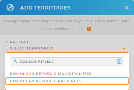
Simply add a new territory from Mapline’s Repository, type DOMINICAN into the searchbar, and select DOMINICAN REPUBLIC PROVINCES.
It’s really that easy! There’s just one more quick step, then your map is ready to support your analytics.


Pro Tip: Leverage Mapline’s worldwide repository of territory boundaries to broaden your territory analysis. Compare and contrast different administrative boundaries, including Dominican Republic municipalities and provinces.
CHOOSE PROVINCE COLORS
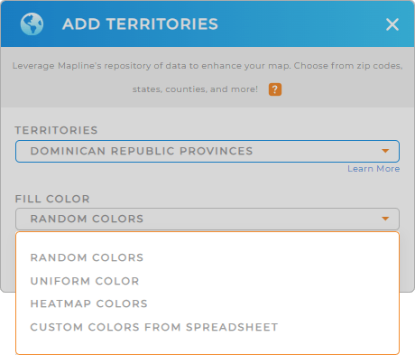
Take your analysis up a notch as you assign colors to your territories. Use static colors to differentiate the province boundaries from each other. Use dynamic color gradients to represent different values in your data.
Just select your preferred color styling, then click OK.
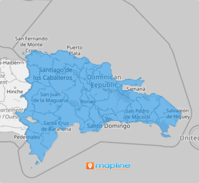
Now your map is ready to empower you to detect patterns and trends! Easily highlight new opportunities or areas for improvement and watch your ROI skyrocket!

GET NEW TERRITORY INSIGHTS
Get even more from your map of Dominican Republic provinces when you leverage these powerful analytics capabilites:
- Visualize data density around your pins through heat maps
- Automate your routes and factor in any constraint or requirement
- Leverage Mapine Data to run advanced calculations that reveal a goldmine of information about your clients and operations


