London Boroughs
- Territory Guide
- London Boroughs
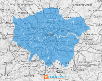
Catalyze a remarkable transformation in your analysis by leveraging a map of London boroughs. When you add borough boundaries to your Mapline territory maps, you supercharge your brand’s analytics and streamline operations. Forget broader territories like regions or provinces—smart brands zero in on boroughs for their tighter focus and richer insights. Quickly reveal customer hotspots and untapped markets, boost your campaign effectiveness, and watch performance skyrocket!
Let’s unleash the full potential of your London Borough map and watch new insights unveil themselves before your eyes.
WHAT ARE LONDON BOROUGHS?
London Boroughs are the 32 districts that, alongside the City of London, make up the vast metropolis of Greater London. Think of them as unique neighborhoods, each with its own flavor and customer base. Mapping these boroughs provides pinpoint accuracy in understanding regional markets, optimizing delivery routes, and identifying high-potential areas. This granular approach can dramatically enhance your sales strategies and marketing outreach, leading to improved results.
ADD LONDON BOROUGHS
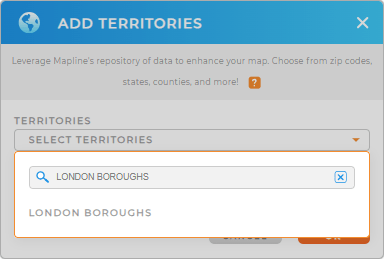
Adding London Boroughs to your Mapline map is a game-changer. This laser-sharp approach reveals opportunities and challenges with pinpoint precision, giving you the edge to strategize smarter and act faster.
Just add a new territory from Mapline’s repository, you can quickly visualize these areas and start uncovering valuable insights. This enhances your market analysis and strengthens your strategic planning and operational efficiency.


Pro Tip: Mapline’s worldwide territory repository is your ultimate tool for mapping boundaries across the globe. This extensive list of territory boundaries allows you to dive deep into regional analysis, inlcuding London wards and boroughs, empowering your business to make smarter decisions and achieve greater success.
CHOOSE BOROUGH COLORS
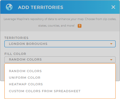
Color-coding London Boroughs on your territory map is like giving your data a superhero costume—suddenly, everything stands out! This visual clarity helps you instantly recognize trends, optimize resources, and enhance your analytics.
Simply select your desired color styles to make key data pop and simplify decision-making.

GET NEW TERRITORY INSIGHTS
Check out these features so you can maximize the use of your London boroughs map:
- Analyze your coverage areas and reach to improve campaigns or distribution
- Filter your data to hone in on specific data points, making it easier to analyze and act on critical information
- Plan the most efficient efficient routes for your team or delivery drivers, saving time and cutting costs


